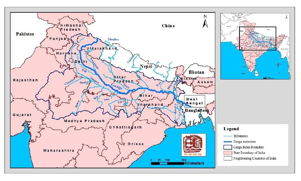
Ganga basin is the largest river basin in India in terms of catchment area, constituting 26% of the country's land mass (8,61,404 Sq. km) and supporting about 43% of its population (448.3 million as per 2001 census). The basin lies between East longitudes 73°02’ and 89°05’ and North latitudes of 21°06’ and 31°21’, covering an area of 1,086,000 sq km, extending over India, Nepal and Bangladesh. About 79% area of Ganga basin is in India. The basin covers 11 states viz., Uttarakhand, U.P., M.P., Rajasthan, Haryana, Himachal Pradesh, Chhattisgarh, Jharkhand, Bihar, West Bengal and Delhi.The current focus of world bank funded National Ganga River Basin Projects (NGRBP) of NMCG is on five major states on the main stem of river Ganga namely Uttarakhand, Uttar Pradesh, Jharkhand, Bihar and West Bengal. The drainage area in uttarakhand state is given below.
| Uttarakhand and Uttar Pradesh | 294,364 |

Total Hits
0000867429
Since
28-02-2018
Site designed, developed and hosted by 
Contents of this website is published and managed by State Mission For Clean Ganga Uttarakhand Namami Gange. For any queries regarding this website please contact SMCG Office at 105 Rajpur Road, Near RTO Office Dehradun, Ph. 0135-2769932 / 2769998
© 2018 State Mission For Clean Ganga Uttarakhand.